| 1981 | 1982 | 1985 | 1986 | 1987 | 1990 | 1991 | 1994 | 1995 | 1996 | 1997 | 2000 | 2001 | 2002 | 2003 | 2004 | 2007 |

2001
Picture gallery
Photo album
Slide show
| Day5: 25 August, Ruohtesvagge (Nijak) - Skarja, 18 km | |
|
I sit on the rocks at the entrance to Guohpervagge, where Guohperjåhkå throw itself down to the wet flat land beneath the rocks. The stream roar. The flat land stretch towards and pass Skarja a few kilometers away. The sun has a few minutes ago disappeared behind the mountains in Guohpervagge behind me. The shadows has become long, and the sunrays run almost paralell with the slope of Oalgasj. It has been a long and interesting day, which started seven in the morning. The weather is always interesting when being out like this, though one has to accept it whatever it happens to be. Todays forecast is varying cloudiness, with high clouds, and no rain. The forecast was done by looking out from the tent beneath Nijak in Rouhtesvagge, which was the first thing done. All the peaks on both sides of the valley are clearly seen, it looks promising for the rest of the day. The valley is one of the easiest to walk, with large grassy areas. At the brook from Nijakvagge is a wide stony groove, telling that the jåhk can be violent, but today does it reside in the middle as a narrow brook. We continue towards the small hill Ruohtesvarasj (1004), with the flat top about 100 meter above the surroundings. East of it, where the brook from the lake Ruohtesjavrasj finds its way north, are marshes. These we avoid by before the hill walking down to brook , and cross it. Here we find the track that run though all of the valley. It pass between the hill and the lake. After the hill do the glacier Oarjep Ruohtesjiegna show up between Ruohtestjåhkkå (1664) and Gasskatjåhkkå (1759). We meet a lone young man, he do not say hello. We feel old. We continue on the track, which spread out and vanish at the many brooks from the glacier. At this time of the year are the brooks not so difficult to cross, only one is wide and streaming. On the other side is it again a good track, moors and marshes succeed each other. The marshes are weared and muddy. We meet two older gentlemen, slowly proceeding in the opposite direction. We have still many years in front of us, we feel young. In the middle of the valley make Smajllajåhkå a deltaland, on the other side is the Sarek massif a contonuous wall. After the corner of Boajsatjåhkå do we have the Oalgasj massif in front of us. We meet two young men, rapidly proceeding in the opposite direction. We feel old. The track lead us down to the Smajllajåhkå, which has become streaming and fierce. Where Mihkajåhkå join Smajllajåhkå do we get a glimpse of the glacier Mihkajiegna, and behind it the peaks Stortoppen (2089), and Sydtoppen (2023). The weather is fantastic, sunshine and 18 degrees. Smajllajåhkå gain further strength from Mihkajåhkå, and fall violently down in the canyon at Skarja. This is where Rouhtesvagge meet the upper part of Rapadalen. Skarja is a central place in Sarek, due to the bridge over the canyon. Without the bridge would one get problems to cross. I have several times forgotten to take a photo of the bridge, now I do it. At the locked Mikkacabin is a solar cell driven emergancy phone. Many find their tenting site here, at the moment are we alone, but we look for a less popular place for our lodging. There is a good tenting site at the rapids of Guohperjåhkå a few kilometers away, which we have used before. Walking towards Guohpervagge is best done up on the slope, there is a sometimes visible track. Down in the valley is there a large wetland around the jåhk.. We soon loose the track, and get involved in stones and osier. From up here can we see the rapids, with Skårvatjåhkå (1881) as the sidescene. We fight our way down through osier, between and on stones, to the green flat area where Guohperjåhkå fall down to the wetland beneath. I sit on the rocks, with the setting sun behind me. Beneath the rapids is Guohperjåhkå winding through the landsacpe, now in shadow. Only the mountains around Pastavagge are illuminated. |
Ruohtesvárásj and Gisuris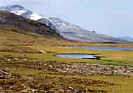 The brook from Ruohtesjiegna 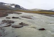 Smajllajåhkå 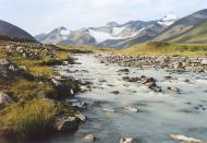 Campsite 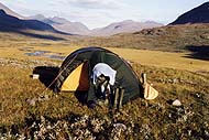 |